Articles in this Topic

    Spatial Commons (14) – Entangled Communities Ostbahnhof [Studio]

    Course Description

    Teaching

    Open Studio: Friday, 08.04.22 | 10 Uhr | Zoom

    Introduction: Thursday, 21.04.22 | 10 Uhr

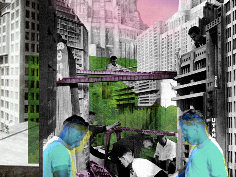
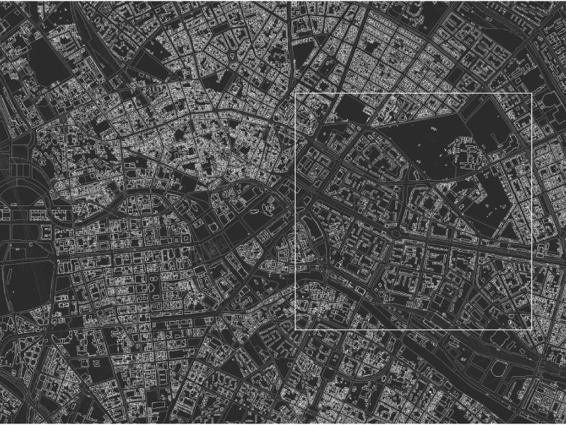
    The area around Ostbahnhof between Spree and Karl-Marx-Allee is a patchwork of different urban fragments. Due to various current plans, major urban development changes are expected around the Ostbahnhof in the coming years.

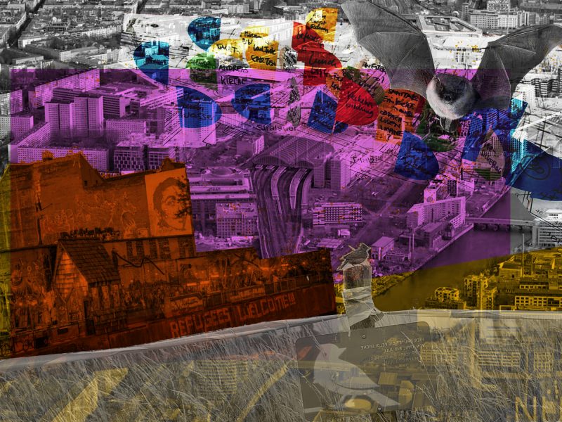
    The design studio ‘Entangled Communities Ostbahnhof’ is looking for visions of a new neighbourhood oriented towards the common good and mixed uses. To achieve this we will explore the interests of existing actors and possible future communities in various scenarios in order to facilitate a community-oriented and empowering planning and design. The community concept will be expanded by a more-than-human urbanism perspective and deepened in the accompanying PiV. The objective is to include non-human actors who live on site, to understand and to incorporate their needs into the design concepts.

    We ask what qualities on a spatial, organisational, ecological, economic and social level are needed by the different human and non-human actors and how these can be combined in a vision for a neighbourhood around the Ostbahnhof?

    According to the principle “No Design without Community – No Community without Design”, the designs will serve as a base to discuss a further development process with the district and interested actors and communities. We will exchange ideas with LokalBau and the Bezirksamt F’Hain/X’Berg and our designs will build on and challenge their envisaged scenarios for the area.

    The PiV focusses on multi-species cohabitation in order to apply it in analysis and design. It will be conducted by architect Jamie Baxter (BUA) and urban ecologist Dr. Tanja Straka (Institute for Ecology). The Studio and PiV are held in English. The PiV is obligatory for the participants of the studio.

    Participants: 16 Städtebau I + 4 Städtebau II

    MA Architektur: Städtebau I (12 LP incl. PiV)
    MA Architektur: Städtebau II (12 LP incl. PiV)
    + MA Architektur: städtebauliche Vertiefung (9 LP)
    MA UD Urban Design – Projekt Architektur (12 LP)

    Anmeldung über MOSES.

    Team: Julia Köpper & Jamie Baxter (LA)


    Hybrid Knowledge/Hybrid Space - At the Botanical Gardens and Museum Berlin [Seminar]

    Course Description

    Teaching

    First session: Wednesday April 14th, 2021 | 10am | Zoom

    The seminar, part of an ongoing working group hosted at the SFB 1265 “Re-Figuration of Spaces”, aims to methodically and practically examine mapping methods towards a critical, creative and reflexive approach to socio-spatial research and design. We will research and render visible the trans-local spatial assemblages, diverse actors and material infrastructures at work in the co-production of knowledge connected to the Botanical Garden and Museum Berlin (BGBM). The project starts from the hypothesis that scientific knowledge is co-produced between scientists and non-scientists and that this process of hybrid knowledge production structures trans-local spatial assemblages that traverse site, city and national boundaries, involving all kinds of human and non-human actors.

    Museums and research institutions are changing to cope with the accelerated transformation and emerging needs of society in this time of socio-environmental crisis. Historically, institutions like the BGBM have produced and transferred valuable knowledge on our naturalcultural environment to society. However, with these changing roles new ways of co-producing knowledge with society are being presented. During the seminar, we will start by mapping specific ‘sites’ associated with  the production, dissemination and transfer of knowledge at the Botanical Gardens (the museum, greenhouses, gardens, data banks, labs etc.). We will examine how, by whom and for what purpose knowledge is produced and arranged territorially. In the second step, we will consider how other spatial figures (e.g. networks and trajectories) come into view as knowledge circulates, transforms and transgresses territorial boundaries, drawing-in multiple other spaces and contexts translocally. In the third step, we ask, how these processes are constitutive of other, new spaces. 

    For example, we will begin by considering how cacti are spatially arranged, where they are placed in relation to other species, how they arrived at the BGBM, which other sites and places they travelled through, and under which conditions? How are they classified and categorized? What atmosphere needs to be reproduced to allow them to grow in northern Europe and for what purpose?  And, what role do scientific and non-scientific networks play in what is understood about cacti, how do cacti transform as they circulate through and between such networks, how and where are these networks connected? What material infrastructures, such as soil, labs, flowerbeds, exhibitions, home gardens, nurseries, shops etc. facilitate these circulations and transformations? Are there specific trajectories which are more important than others in the flows of information, knowledge and power?

    Methodologically, we will conduct site visits, interviews, photography, surveying and drawing to collect data on sites at the BGBM. We will then discuss, develop and apply what we call the ‘Hybrid Mapping’ methodology, a mapping approach combining sociological and architectural research perspectives.

    Participants: max. 20 + 5 M-Arch-T

    4 SWS – 6 ECTS

    Quisposnumber: 5485

    Please register with CUD via E-Mail

    Team: LA Jamie-Scott Baxter, Séverine Marguin, Sophie Mélix

    Berlin Brandenburg 2040: IN TOUCH

    Licht Luft Scheisse

    Teaching

    Lecture by Sandra Bartoli and Silvan Linden | Friday 29.01.2021 | 5pm | Zoom

    The ecological question is not new. Over a hundred years ago, conceptual models and practices were already being developed in reaction to increasing industrialization and urbanization, which still resonate with our current ideas of sustainability. These approaches reflected not only a systematic understanding of the interactions between humans and the environment, and between nature and technology, but also the growing awareness of a modernity that is depriving itself of the basis of life.

    These themes form the focus of the books Licht Luft Scheisse – Archaeologies of Sustainability and Licht Luft Scheisse – Über Natur (adocs Verlag, 2020), co-edited by Sandra Bartoli, Silvan Linden, and Florian Wüst. The publications form the outcome of a research project started in 2014 exploring an environmental history of architecture that concluded with two homonymous exhibitions curated by the trio in Berlin in 2019 at the Botanical Garden Museum and the neue Gesellschaft für bildende Kunst (nGbK). The publication Archaeologies of Sustainability in particular includes 171 contributions consisting of images, documents, texts, and artworks from the last two centuries. The project was financed by the German Federal Cultural Foundation and the Lotto Stiftung.

    News

    Rethinking Planning in a More-than-human world

    News

    Prof. Jean Hillier | RMIT Melbourne

    Wednesday 13th November 2019 | 6.30 pm

    TU Berlin Building of Architecture | Main Lecture Hall, A151


    Spatial planning is not external to the eco-social realities which co-produce the Anthropocene. Emeritus Professor Jean Hillier is concerned with spatial planning, its multispecies entanglements and the production of novel ecosystems, including those of damaged landscapes. Many planning systems reinforce hyper-separated categories of ‘nature’ and ‘culture’, reflected in the separation between land-use planning and environmental conservation planning. The ‘unreflected imposition of human primacy upon the desires and habits of other beings’ (Metzger, 2014: 210) and resulting asymmetric ‘negotiations’ between human planners and nonhuman others, have contributed to often-catastrophic changes across the globe. She argues that planning academics and practitioners should think carefully and critically about who speaks for (and with) the nonhuman in place making. She introduces the concept of ‘more-than-human’, as developed in geography and the environmental humanities, to explore new possibilities for productively rethinking the ontological exceptionalism of humans in planning theory and practice. She argues the need to develop inclusive, ethical relationships that can nurture possibilities for multispecies flourishing in diverse urban futures: a co-adaptive, more-than-human multispecies entanglement.

    Jean Hillier is Emeritus Professor of Sustainability and Urban Planning at RMIT University, Melbourne, Australia. Her research interests include poststructural planning theory and methodology for strategic practice, planning with non-human animals, and problematisation of cultural heritage practices in spatial planning, particularly in China. Recent books include Connections: exploring contemporary planning theory and practice with Patsy Healey (2015), edited with Jonathan Metzger; Deleuze and Guattari for Planners (InPlanning e-book, 2013); Complexity and the Planning of the Built Environment (2012) edited with Gert de Roo and Joris Van Wezemael, the Ashgate Research Companion to Planning Theory: Conceptual Challenges for Spatial Planning (2010) edited with Patsy Healey. Relevant articles include: ‘Is extermination to be the legacy of Mary Gilbert’s cat?’ (with Byrne J.) Organization (2016); ‘Make kin, not cities! Multispecies entanglements and ‘becoming-world’ in planning theory’, (with MacCallum, D., Steele, W., Houston, D. and Byrne J.) Planning Theory (2017); ‘Cat-alysing attunement’, Journal of Environmental Policy & Planning (2017); ‘No Place To Go? Management of Non-Human Animal Overflows in Australia’, European Management Journal (2017).

    http://cur.org.au/people/professor-jean-hillier/

    It is a cooperation between the SFB 1265 Re-Figuration of Spaces and IRS – Leibniz Institute for Research on Society and Space on behalf of AESOP.

    Berlin XX XL* [Studio]

    Course Description

    Teaching

    Urban Design Studio

    In the context of the forthcoming 2020 centenary of Greater-Berlin the studio will look at the city’s past (built, unbuild, destroyed, forgotten) and present (contested, procrastinating, path-dependent) to speculate on its future (socially and ecologically aware, sustainable, beautiful). Based on the study of current transformation drivers as well as local/global tendencies students will use an imagined Berlin placed in the years 2040/2070 as a laboratory for scenario building through speculative design approaches. Revisiting the bold move that unified eight independent cities, 59 rural communities and 27 estates within a single legislative act in 1919, the studio will rethink administrative boundaries, spatial constellations, infrastructures and resource flows from Mitte to the Hinterlands.

    Divergent scenarios will be developed with help of external experts on topics ranging from transformation design, climate change, resource and food security, energy, age or housing – combining research with speculative design in a playful manner. The studio will participate in the open urban design competition “100 years of (greater) Berlin International Urban Design Ideas Competition Berlin-Brandenburg 2070”.

    * Roman numereals “20 40” I Generic Sizes “Superlarge”

    Die letzten Stunden von Berlin (1) - "Et au milieu, le vide" [Studio]

    Kursbeschreibung

    Teaching

    Die letzten Stunden von Berlin ist eine Reihe von Workshops, Studios, Seminaren und Events, die ab WS17/18 das städtebauliche Modell Berlins im Hinblick auf sein heutiges Wachstum hinterfragen soll. 1977 entwickelte der deutsche Architekt O.M. Ungers für das damals geteilte, schrumpfende Berlin das Konzept des Grünen Archipels: Städte in der Stadt. Wobei das Modell immer weniger zu einer vereinten, sich re-zentralisierenden und nun wachsenden Stadt zu passen scheint, versprach es die Möglichkeit einer radikalen Koexistenz / Co-Habitat zwischen Natur und gebauter Umwelt, Mensch und Baum, Tier und Neon, Stille und Beats. Diese hat Berlin seit Anfang der 90er Jahre tatsächlich charakterisiert. Wildnis (sozial & ökologisch) wurde zum wesentlichem Parameter einer emanzipierenden Stadt. Während unseres Entwurfsworkshop (Format: „Strassenarbeiten“, siehe WS11>16) wollen wir gerade diese Wildnis mitten in Berlin (vom Alexanderplatz zur Weberwiese, vom Volkspark Friedrichshain zum Berghain) in der Tiefe untersuchen. Ein Hin und Her zwischen Kartierung, Sammlung von Protoypen und Imagination von Zukunftsszenarien soll es erlauben, Hypothesen zu Berlin zu formulieren und andere, lang unsichtbare, Milieus ans Licht zu bringen.